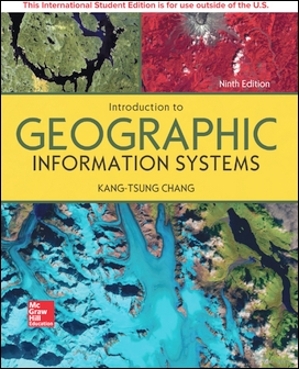
Description Introduction to Geographic Information Systems, 8th edition is designed to provide students in a first or second GIS course with a solid foundation in both GIS concepts and the use of GIS. Introduction to GIS strikes a careful balance between GIS concepts and hands-on applications. The main portion of the chapter presents GIS terms and concepts and helps students learn how each one fits into a complete GIS system. At the end of each chapter, an application section with 2-7 tasks presents students with actual GIS exercises and the necessary data to solve the problem.
Key Features
The text provides data sets and instructions for the applications section in each chapter, as well as challenge tasks, written questions, and review questions for each chapter. Data sets can be found on the student companion site.
Key terms are boldfaced where they first appear in the chapter and then summarized and defined with a glossary at the end of the chapter.
The author created all the figures and tables ensuring precise correlation between the chapter material and their accompanying visuals.
The author has combined georelational and object-based vector data models into one chapter. A couple of years ago the majority of GIS users were still using georelational vector data such as shapefiles. But now many have turned to object-based vector data such as the geodatabase. Therefore it makes sense to combine these two data models into a chapter and simply call the chapter vector data model.
The text-specific website offers additional teaching and learning tools for students and instructors. Students will find data sets for ArcGIS applications in the text and that correspond to ArcGIS 10. Additionally, students will find exercise data sets and chapter web links to existing GIS data and relevant information. Instructors will appreciate a password-protected Instructor's Manual, PowerPoint image and lecture slides, a listing of exercise data sets, and more!
New to this edition
Chapters 1, 4, 5, 7, and 17 have been completely overhauled.
New lab exercises have been introduced on spatial join, areal interpolation, line-of-sight operations, and land cover image.
Six new tables, nine new boxes, and five new figures have been added.
Web sites and references have been updated.
Table of Contents
1 Introduction
2 Coordinate Systems
3 Vector Data Model
4 Raster Data Model
5 GIS Data Acquisition
6 Geometric Transformation
7 Spatial Data Accuracy and Quality
8 Attribute Data Management
9 Data Display and Cartography
10 Data Exploration
11 Vector Data Analysis
12 Raster Data Analysis
13 Terrain Mapping and Analysis
14 Viewshed and Watershed Analysis
15 Spatial Interpolation
16 Geocoding and Dynamic Segmentation
17 Least Cost Path and Network Analysis
18 GIS Models and Modeling